
Mapping Earth’s cryosphere and inland waters with satellite radar altimetry
-

-
REFERENCES
[1] McMillan M., Muir A., Shepherd A., et al. (2019). Sentinel-3 Delay-Doppler altimetry over Antarctica. TC 13:709−722. DOI:10.5194/tc-13-709-2019 [2] Huang Q., McMillan M., Muir A., et al. (2024). Multipeak retracking of radar altimetry waveforms over ice sheets. Remote Sens. Environ. 303:114020. DOI:10.1016/j.rse.2024.114020 [3] Gourmelen N., Escorihuela M., Shepherd A., et al. (2018). CryoSat-2 swath interferometric altimetry for mapping ice elevation and elevation change. Adv. Space Res. 62:1226−1242. DOI:10.1016/j.asr.2017.11.014 [4] Kleinherenbrink M., Naeije M., Slobbe C., et al. (2020). The performance of CryoSat-2 fully-focussed SAR for inland water-level estimation. Remote Sens. Environ. 237:111589. DOI:10.1016/j.rse.2019.111589 [5] Song L., Song C., Luo S., et al. (2023). Integrating ICESat-2 altimetry and machine learning to estimate the seasonal water level and storage variations of national-scale lakes in China. Remote Sens. Environ. 294:113657. DOI:10.1016/j.rse.2023.113657 -
ABOUT THIS ARTICLE
Cite this article:
Huang Q., Maddalena J. and McMillan M. (2025). Mapping Earth’s cryosphere and inland waters with satellite radar altimetry. The Innovation Geoscience 3:100134. https://doi.org/10.59717/j.xinn-geo.2025.100134
Welcome!
To request copyright permission to republish or share portions of our works, please visit Copyright Clearance Center's (CCC) Marketplace website at marketplace.copyright.com.
Export File
Citation
Huang Q., Maddalena J. and McMillan M. (2025). Mapping Earth’s cryosphere and inland waters with satellite radar altimetry. The Innovation Geoscience 3:100134. https://doi.org/10.59717/j.xinn-geo.2025.100134

Format
Content
 DownLoad:
-
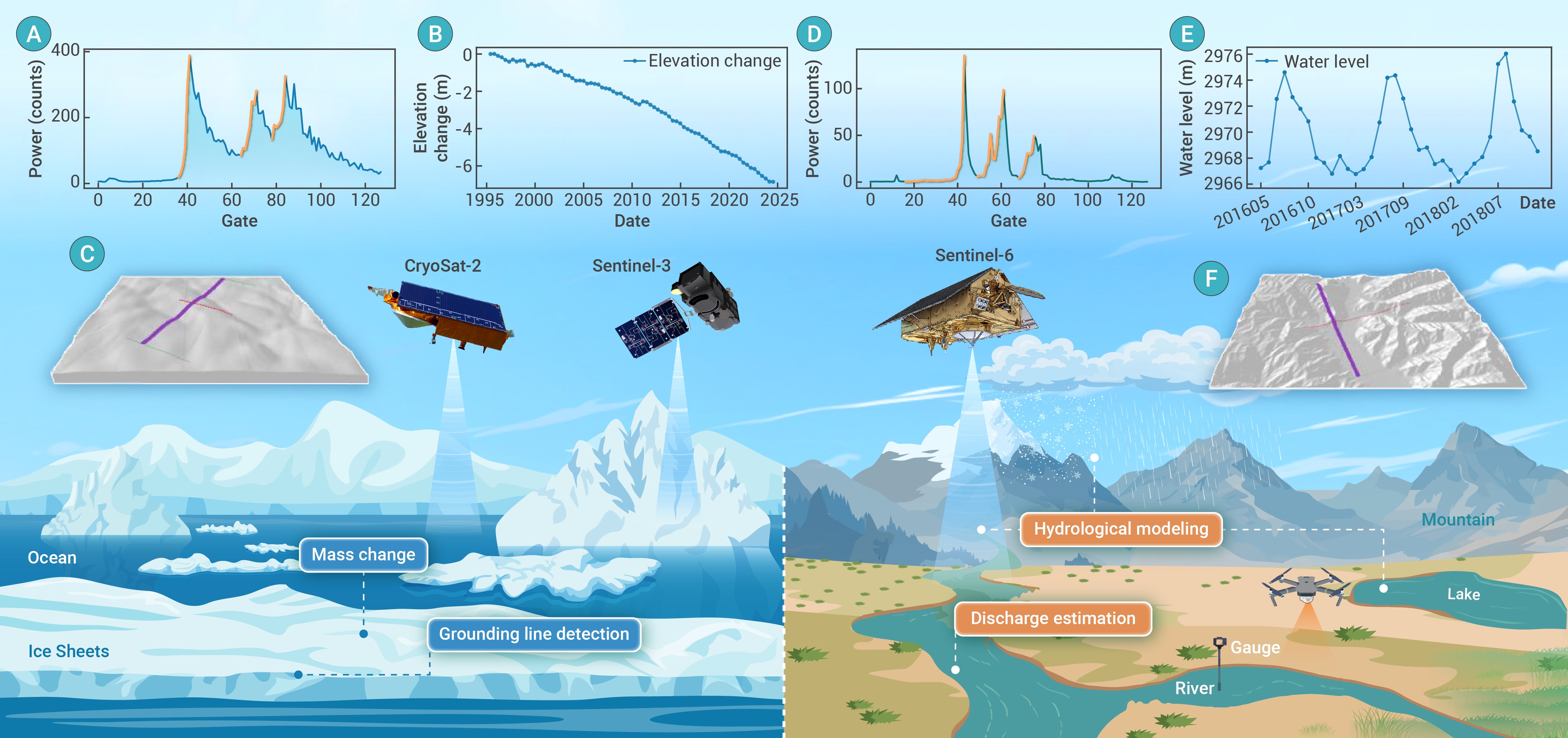
Figure 1.
Monitoring cryosphere (e.g., ice sheets and mountain glaciers) and inland water (e.g., rivers and lakes) using radar altimeters (e.g., CryoSat-2, Sentinel-3, and Sentinel-6) with examples of downstream applications:
