
Renewed understanding of pond classification systems: A perspective on multifunctional remote sensing classification
-

-
REFERENCES
[1] Verpoorter C., Kutser T., Seekell D A., et al. (2014). A global inventory of lakes based on high‐resolution satellite imagery. Geophys. Res. Lett. 41:6396−6402. DOI:10.1002/2014GL060641 [2] Pyke C R. (2010). Assessing suitability for conservation action: Prioritizing interpond linkages for the California tiger salamander. Conserv. Biol. 19:492−503. DOI:10.1111/j.1523-1739.2005.00018.x [3] Zhen J., Mao D., Wang Y., et al. (2026). National mapping of wetland vegetation leaf area index in China using hybrid model with Sentinel-2 and Landsat-8 data. ISPRS J Photogramm. 232:18-33. DOI:10.1016/J.ISPRSJPRS.2025.11.031 [4] Tong Y., Lin C., Song K., et al. (2025). Reconstructing coastal ponds functional classification: Integration of multi-feature remote sensing. Ecol. Inform. 91:14. DOI:10.1016/J.ECOINF.2025.103370 [5] Bai X., Lin C., Wang S., et al. (2026). Ponds greatly influence watershed ecosystem services value: An optimized InVEST model for large-scale. J. Hydrol. 668: 135026. DOI:10.1016/j.jhydrol.2026.135026 -
ABOUT THIS ARTICLE
Cite this article:
Tong Y., Lin C., Feng W., et al. (2027). Renewed understanding of pond classification systems: A perspective on multifunctional remote sensing classification. The Innovation Geoscience 5:100262. https://doi.org/10.59717/j.xinn-geo.2026.100262
Welcome!
To request copyright permission to republish or share portions of our works, please visit Copyright Clearance Center's (CCC) Marketplace website at marketplace.copyright.com.
Export File
Citation
Tong Y., Lin C., Feng W., et al. (2027). Renewed understanding of pond classification systems: A perspective on multifunctional remote sensing classification. The Innovation Geoscience 5:100262. https://doi.org/10.59717/j.xinn-geo.2026.100262

Format
Content
 DownLoad:
-
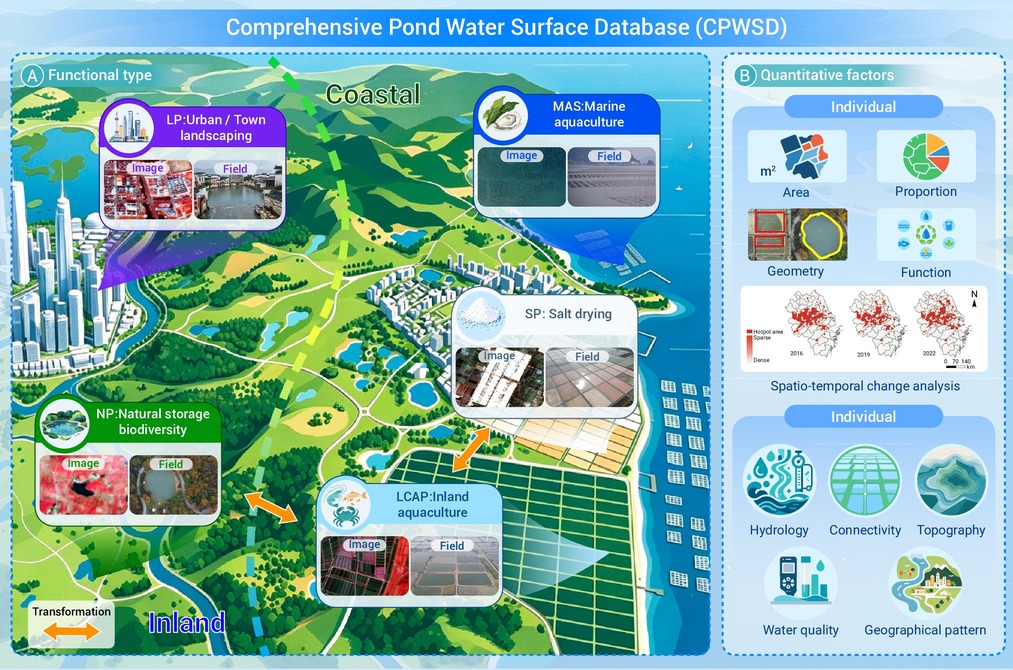
Figure 1.
A vision for comprehensive pond water surface database (CPWSD)
